Navigate in style
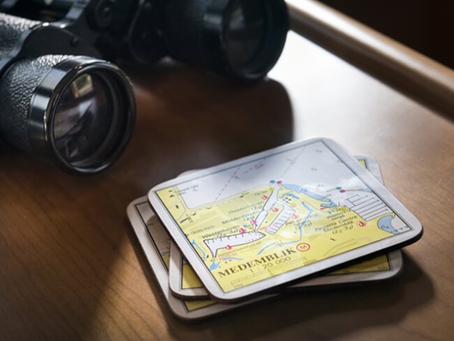
The Netherlands Hydrographic Service “1800” series nautical charts for secure navigation: any water sports enthusiast will no doubt be carrying them on board. Although so far we would only see them in navigation rooms, the launch of the ARC Marine “1800” collection will now find them back in cocktail environments as well!

Hydrographic Service
The Netherlands Hydrographic Service is part of the Dutch Royal Navy. It was instituted for the purpose of informing seafarers about waterways, the seabed and submerged perils like shipwreck locations. This is done by way of detailed nautical charts for instance. But as these charts tend to age soon, the Service also issues ‘Notices to Mariners’ updating water sports enthusiasts on prevailing shallows, currents and so on.
“1800” collection
Extending all the way from the North Sea shore until the Oosterschelde river, each region is assigned its own nautical chart bearing a unique number, ranging from 1801 to 1812. This year, together with Vrolijk Watersport, ARC Marine introduces a new collection of nautical accessories aptly named “1800”. It contains items like coasters, place mats and serviettes decorated with the familiar, characteristic Netherlands Hydrographic Service charts, and will enable the captain to chart the course while enjoying a nautical drink with his guests.
Availability and Delivery
There are three different coaster sets, each of them containing 6 items. They are: Delta Waters (Willemstad, Herkingen, Bruinisse, Breskens, Brouwershaven, Hellevoetsluis), IJsselmeer/Markermeer (Lemmer, Medemblik, Hoorn, Monnickendam, Enkhuizen, Muiderzand) and North Sea/Wadden Sea (Vlieland, West-Terschelling, Den Helder, Oudeschild, Harlingen, Scheveningen). The coasters are available from mid June; the serviettes are available right now from your agent or through www.arcmarine.eu.


